Flood hazard maps in Greece: how to find the map for your area
Greece publishes official flood maps for the whole country. Few people know where they are, or how to read a "100-year" flood. This is a short guide to both.
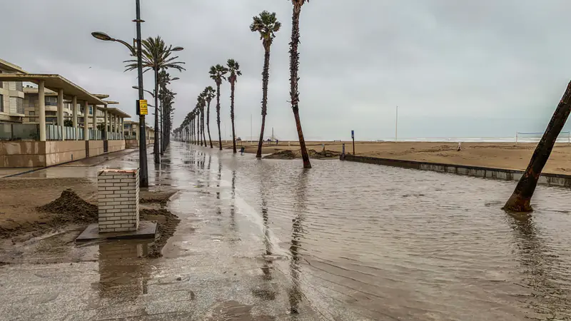
Flood hazard map or flood risk map?
The two terms sound alike but are not the same. The EU Floods Directive 2007/60/EC defines a flood as the temporary covering by water of land that is normally dry. It includes floods from rivers, mountain torrents, ephemeral Mediterranean watercourses and the sea in coastal areas. Floods from sewer systems may be excluded. Flood risk is the combination of the probability of a flood and its potential harm to human health, the environment, cultural heritage and economic activity.
From this come two kinds of map, under Article 6 of the Directive:
- Flood hazard map: shows the physical event. For each scenario it shows the flood extent, the water depth or level where relevant and, where appropriate, the flow velocity.
- Flood risk map: shows the consequences. It includes the indicative number of inhabitants potentially affected, the types of economic activity, installations that could cause pollution if flooded, and protected areas.
Put simply: a hazard map says where the water could reach and how deep. A risk map says who and what is there.
Flood risk management plans and the EU Floods Directive
The Directive organises the work in three steps, with a six-year review. The European Commission notes that floods are the most common and most costly natural disasters in Europe.
| Step | First deadline | First review |
|---|---|---|
| Preliminary flood risk assessment | 22 December 2011 | 22 December 2018 |
| Flood hazard and flood risk maps | 22 December 2013 | 22 December 2019 |
| Flood risk management plans | 22 December 2015 | 22 December 2021 |
After the first review, each step is revisited every six years, and reviews must take into account the likely impact of climate change. The Commission counts the cycles as 2010–2015, 2016–2021 and 2022–2027. The plans focus on prevention, protection and preparedness, including forecasts and early warning. The Directive also requires the maps and plans to be made available to the public.
In Greece, the Ministry of Environment and Energy (YPEN) publishes them at floods.ypeka.gr, in Greek only. The site has three sections: the approved flood risk management plans of the 1st cycle, the 2nd cycle (which the site calls the "1st revision") and the 3rd cycle. When we checked, the 3rd cycle only had the preliminary assessment for the whole country.
How to find the flood hazard map for your area
The maps are organised by river basin district (Υδατικό Διαμέρισμα). Greece has 14, coded EL01 to EL14. For example, Athens is in EL06 Attica, Larissa and Volos are in EL08 Thessaly, and the Aegean islands are in EL14.
- Open floods.ypeka.gr.
- From the "ΣΔΚΠ" menu, choose "ΧΑΡΤΕΣ ΚΑΙ ΣΔΚΠ ΑΝΑ ΥΔ – 2ος ΚΥΚΛΟΣ" (maps and plans by district, 2nd cycle). This is the most recent cycle with maps.
- Click the "ΥΔΑΤΙΚΟ ΔΙΑΜΕΡΙΣΜΑ" link for your area (for Athens, EL06).
- For an interactive map, go to "ΓΕΩΠΥΛΗ" (geoportal) and click "Είσοδος στη Γεωπύλη". It holds the areas of potentially significant flood risk, the flood hazard maps and flood risk maps, and updated rainfall intensity-duration curves. The page links to detailed user instructions.
- Check which scenario you are looking at (50, 100 or 1000 years) before drawing a conclusion.
For engineers and analysts, the geoportal also serves the data through viewing, download and search services based on open standards (WMS, WFS, CSW).
Return periods: what 50, 100 and 1000 years mean
The Directive asks for maps of three scenarios: low probability or extreme events, medium probability with a return period of at least 100 years and, where appropriate, high probability. In the 2nd cycle, YPEN provides maps for return periods of 50, 100 and 1000 years.
A "100-year flood" does not mean it comes once a century. According to the US Geological Survey (USGS), it means a flood with a 1% chance of happening in any given year. It can happen two years in a row. By the same logic, a 50-year flood has a 2% chance each year, and a 1000-year flood 0.1%.
YPEN flags two limits. The 2nd-cycle maps use rainfall data up to 2022. And rain of the same volume and duration, but spread differently over time, would give a different result. A flood map is a scenario, not a forecast for tomorrow.
Thessaly after Storm Daniel
The storm began on 4 September 2023 and lasted four days. According to NASA's Earth Observatory, Thessaly saw record rainfall on 5 September. What the satellites mapped is covered in our article on Storm Daniel.
On 18 September 2024, floods.ypeka.gr announced consultations on the strategic environmental assessments of the 1st revision in six districts, including EL08 Thessaly. These are not new maps, but environmental studies of the plans. In our reading, events like Daniel are exactly the evidence each later review should use.
Before, during and after a flood
A map shows what could happen. What to do when it does happen is set out by Greece's civil protection ministry. In short:
- Before: if you live in an area with past floods, stay alert. When heavy rain is forecast, check that drains and gutters are clear, and avoid basements.
- During: move to higher ground. Do not cross a torrent or a flooded low-water crossing, on foot or by car. If your car stalls, leave it. Follow the authorities' instructions.
- After: do not return until the authorities say it is safe. Switch off power and water, watch for mudflows and contaminated water, and do not get in the way of rescue teams.
Official maps and warnings always come first. Our flood risk page describes how a digital twin could add scenarios to them. Kassandra Labs is at concept stage and does not produce official maps.
Frequently asked questions
What is a flood hazard map?
It is an official map showing where water could reach in a flood, for different probability scenarios. Under the EU Floods Directive, it shows the flood extent, the water depth or level and, where appropriate, the flow velocity. It differs from a flood risk map, which shows the people, economic activities and installations in the area that could be affected.
What is the EU Floods Directive?
Directive 2007/60/EC requires EU countries to assess flood risk, prepare flood hazard and flood risk maps, and adopt flood risk management plans. The first deadlines were 2011, 2013 and 2015, and each step is reviewed every six years, taking climate change into account. The maps and plans must be made available to the public.
Where can I find flood maps for Greece?
The Ministry of Environment and Energy publishes them at floods.ypeka.gr, in Greek. Maps are organised by 14 river basin districts, coded EL01 to EL14; Athens is in EL06 Attica. Use the "ΣΔΚΠ" menu for the 2nd-cycle maps, or the geoportal for an interactive view. Always check which return period scenario you are viewing.
What does a 100-year flood mean?
It means a flood with about a 1% chance of happening in any given year, not one that comes once a century. It can happen in two consecutive years. The EU Floods Directive asks for a medium-probability scenario with a return period of at least 100 years. Greece’s 2nd-cycle maps also show 50-year and 1000-year scenarios.
Sources
- ΥΠΕΝ — Σχέδια Διαχείρισης Κινδύνων Πλημμύρας (floods.ypeka.gr)
- ΥΠΕΝ — Χάρτες και ΣΔΚΠ ανά Υδατικό Διαμέρισμα, 2ος κύκλος
- ΥΠΕΝ — Γεωπύλη ΣΔΚΠ
- Directive 2007/60/EC on the assessment and management of flood risks (text as adopted, legislation.gov.uk)
- European Commission — Floods
- Υπουργείο Κλιματικής Κρίσης και Πολιτικής Προστασίας — Οδηγίες προστασίας: Πλημμύρες
- USGS Water Science School — The 100-year flood
- NASA Earth Observatory — "A Deluge in Greece", September 2023